It often happens that parents reduce their preschooler’s acquaintance with geography to only studying maps, memorizing state capitals and memorizing flags. But geography is very vast, has many sections and touches almost every aspect of our lives. This is not only a geographical map...
The concept of geography also includes meteorology, ethnography, geology, ecology, local history, geodesy, geophysics, tectonics and many other related sciences. And this is perhaps the most interesting area of knowledge for a child. After all, any little person is very interested in the structure of the world around him. He is concerned about travel and distant countries, the people and animals that live there. He asks many questions about why earthquakes happen and volcanoes erupt, why the sea always rolls waves onto the shore and why the water in it is salty, what is located underground and at the bottom of the ocean...
Our home is Earth
The baby's first ideas about himself and the world around him are usually very fragmented and unsystematic. Our task as parents is to help the baby realize that every person (including the baby himself) is part of this world. Where to start? First of all, introduce your baby to our amazing planet. Your story might sound something like this: “Every person has his own home. You have it too. You live in it with mom and dad. But all, all people have one more big common home - our beautiful planet Earth. The sky is like a huge blue ceiling, and the ground we walk on is the floor. One big sun shines for everyone. The rain pours on us, like a shower, and the breeze blows across us. A long time ago, many, many years ago, people knew nothing at all about our planet. They thought that the Earth was like a big pancake and lay on the backs of three whales or three elephants, which stood on a giant turtle. When animals began to move, earthquakes occurred on Earth.” Together with your child, you can draw these elephants, and the turtle, and the Earth on their backs and laugh together, because anyone, even the smallest child, knows very well that the Earth is not a pancake, but a huge ball. Of course, a globe will be very useful to you. After all, only with its help will the baby be able to at least slightly imagine what our planet really looks like. Perhaps this is how astronauts from deep space see it. This one is as tiny as a ball.
Ancient people once decided to swim to the ends of the earth. They boarded the ship and after many days of sailing they returned home again, but from the other side. This is how people learned that the Earth is round. Find the point where you live on the map with your baby. Let the baby place his finger on it and, like ancient travelers, move with his finger straight across the globe, without turning anywhere. Came back home"?
Purpose of study
For many adults, geography was not a favorite subject at school. This is not a reason to think that the child will not be interested in it. It is necessary to tell your child about the reality of the existing world in forms accessible to his consciousness as early as possible for several reasons:
- to form the correct attitude towards life, aimed at interest in the world around us and the acquisition of knowledge;
- for the timely development of thinking, speech, imagination, etc.;
- so that school knowledge can be well mastered in the future without violence against the child’s mind and feelings;
- so that the baby does not grow up selfish, since childhood understanding how great the planet Earth is, on which he lives along with billions of people.
Geography lessons will help instill in a child from childhood respect for people of other nationalities. The child will understand that the planet Earth on which he lives needs to be protected and its resources taken care of.
Where does Carlson live?
The sooner a geographical map appears in the baby's room, the better. Don’t think that your baby won’t understand or remember anything. It is enough just to draw the young geographer’s attention to the map from time to time, show and name geographical objects, and very soon the child will know parts of the world, oceans, and even many countries with their capitals.
And diverse children's literature is a real treasury of geographical knowledge. And the more we read to the baby, the broader his ideas about the world around him will be. And not just read, but definitely look on the map for the places where events take place. For such games, it is most convenient if the card hangs directly above the child's bed. So, reading about Carlson’s antics, let’s find the country of Sweden and remember its capital - Stockholm. Getting acquainted with the book about the onion boy Cipollino, we will find on the map his homeland - Italy. We’ll also find out where the mischievous Pippi visited during her sea voyages with her captain dad. Especially good is a children's map of the world with all sorts of biological, historical and fairy-tale object-icons. Kids love to look at them, at the same time memorizing a lot of useful information. But an ordinary physical map of the world or a map of the hemispheres will also work. And it’s easy to make a “developmental” card yourself from the most ordinary one. You can paste stickers and pictures with animals and fairy-tale characters onto images of continents. For example, we will place a sticker with the characters of the cartoon “Madagascar” near the island of the same name. And at the same time, we’ll find something interesting in the encyclopedia and read something interesting about this island with our kids. And let's not forget to follow the path of Marty the zebra and her friends from New York to Madagascar. If you find old magazines or atlases from which you can cut out flags of different states, stick them on the map along with the crumbs. Such games will bring undoubted benefits to the baby and will greatly facilitate further schooling.
Kipling's tales will perfectly acquaint the little geographer with the animal world of India. Let the baby remember the location on the map of this country. Travel across the map with Doctor Aibolit, who went to Africa to treat sick monkeys, and with Nils and a flock of geese. When the baby grows up a little, read him a fairy tale about the adventures of Captain Vrungel. It is simply replete with all sorts of geographical details. Of course, don’t forget to find on the map all the places where the brave captain visited on his famous yacht “Trouble”. Better yet, mark his path with a pencil directly on the map. In general, make it a rule to refer to the map in all cases when in everyday life we are talking about some geographical names, be it reading books, watching cartoons, or telling stories to friends who have returned from a trip. This will help the baby remember a lot of useful information and teach him how to use the map. And all this is practically effortless, as if by itself.
Conditions for classes
In order for geography classes to be successful, it is necessary to take into account the child’s characteristics:
- fatigue;
- heightened sense of self-esteem (at a certain age);
- interest in acquiring knowledge through play;
- the need for your encouragement (verbal).
Based on this, we can conclude about the peculiarities of conducting classes:
- lessons should be short (5-10 minutes);
- you need to trust the child without checking how he has acquired knowledge;
- the lesson should be prepared in advance and interesting, take place in a playful way, with bright, visual materials on geography;
- Praise your child for his interest in activities.
The child needs to be interested in what is being told to him. Geography is an unfamiliar subject for two-year-old children, so you shouldn’t expect specific questions on a variety of topics on the subject.
You can pick up on a third-party question that interests you and develop the topic in the direction you need. Questions should arise from the child after becoming acquainted with a new phenomenon or previously unknown object that captured his imagination.
Watching nature programs on TV is not the best way to introduce geography to a one and a half year old child.
In this case, you are more likely to introduce him to the TV.
It’s better to take him to nature, where there is a varied landscape, a river flows or fields lie. Let him feel the beauty that surrounds him, see the blue sky, the distant horizon. Tell your child that there are other countries far beyond the horizon. That getting there is not at all as easy as it seems.
The child will become familiar with many concepts of physical geography after such a walk. For children four years old and older there are interesting series of cartoons: “Geography for Kids”, “Why”, etc.
In order for your child to have questions, you can buy interesting children's games, toys, magnetic cards, and beautiful pictures on a geographic topic. Using pictures, it is necessary to explain to a child the natural phenomena of the surrounding world, which is studied by physical geography, from the age of one and a half to two years.
The way children absorb information is very interesting. They believe everything unconditionally. Especially if the narrator’s authority does not raise any doubts in their minds. Children are very easy to deceive. Therefore, if you don’t know something, don’t answer the question with nonsense, ask your child for time to think.
Kids get tired quickly. They are unable to study for long periods of time. There is no need to drag out a fascinating story because you are very interested in finishing it. Keep it short, simple and clear. It’s another matter if children are interested in geography, and they themselves ask to talk further.
Usually, kids focus their attention on one object for no longer than five or ten minutes.
Expect to fit your geography lesson in around this time. This requires advance preparation and a thoughtful plan. It is advisable to conduct daily home exercises at the same time.
To teach your child to notice and comprehend the world around him while studying geography, communicate with him on a walk, showing and naming objects and phenomena.
In the footsteps of Cecile Lupan
Many interesting geographical ideas can be gleaned from the book Believe in Your Child by Cecile Lupan. First of all, these are songs with the names of state capitals. You can tell your baby rhymes or sing songs that mention geographical names. After all, in poetry such information is remembered much easier. Here are some examples:
We soar over Italy, We see the eternal city of Rome. And in Spain - Madrid stands in the center of the entire country. Here in France, in Paris, the Tower of all buildings is taller! And in Britain, without a doubt, London is the most important city.
It would be great to read with your child A. Usachev’s wonderful book “My First Geographical Discoveries”, where geography is studied in poetry and is very fun:
There are many islands in the world, So many that you can’t count them... But we can count six large continents: Africa, America (North and South), Australia, Eurasia, Antarctica (Blizzard). What is Eurasia? This is Europe plus Asia: The largest continent arose from two parts of the world!
First acquaintance with geography
The child makes his first “geographical” discoveries on a walk near the house, and asks questions about geography already in preschool age. At first, the baby is still trying to understand why day and night alternate, whether the sun is shining or raining. After a while, the little “why” asks where the water in the clouds comes from, why volcanoes erupt and earthquakes occur.
A child sees the world differently than an adult, so he has many unanswered questions. The task of parents is to help the little person learn about the world around him and organize information “on the shelves.”
Colored seas
Your little one probably already knows that rivers, lakes, seas and oceans are indicated in blue on the map. You can start getting acquainted with the planet’s water resources with the “colored” seas. The kid will be interested to know that on our planet there is a Black, Red, White and even a Yellow Sea. Find them on the map and try together to figure out why these seas have such unusual names. The Yellow Sea has a yellowish tint. The Red Sea is home to special algae. During periods of their intensive growth, it seems that the blue water surface is painted in red-brown tones. The White North Sea really has a very light, almost white color of water. And the Black Sea has long been nicknamed this because of the restless nature and black color of the water during storms and storms.
Or maybe the baby will want to draw these colored seas? What countries are they located near? What kind of people live there? Perhaps your baby has already visited one of these seas (for example, the Black or Red) or you are about to go on a trip. Then he will be doubly interested in learning more about these amazing seas.
And then find it on the map and look at other seas. And also try to understand the origin of their names. This will not only expand the child’s geographical knowledge, but also train his thinking, ingenuity and imagination. After all, you can put forward fantastic versions. And then, together with your mother, find information in a children's encyclopedia or on the Internet and check your guesses. After all, why the Mediterranean Sea was called that way, the child will probably guess for himself. You just need to look carefully at the map. The Sea of Japan and South China Sea, for example, will not cause any difficulties. But you will have to think about the origin of the name of the Dead Sea.
Geography in elementary school
Geography, although it appears in the curriculum from grades 5-6, is studied in elementary school as the subject “The World Around Us” or “The World Around Us.” Success in teaching children largely depends on how interesting and educational information is presented in the lessons. It is best to consolidate children's knowledge about the world around them in elementary school in a playful way, so teachers show imagination, resourcefulness, and come up with various games and quizzes.
However, not only the teacher should teach the child geography. Parents should help the student consolidate knowledge, organize it, and understand what he does not understand. Here are some ideas to make learning geography fun.
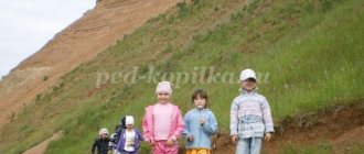
Geography on a walk
Where is the best place to study Earth Science?
On a walk, of course. Better yet, organize a real scientific expedition with your child. To do this, it is not at all necessary to go on a multi-day hike. Just on one sunny fine day, tell your child that today you are not just going for a walk. You are going on a journey. What do you need for a real trip? Comfortable clothes and shoes, a backpack and, of course, something tasty to refresh yourself at the rest stop. Ready? Then let's go! It doesn’t really matter where you go with your young traveler: to the forest, park, to the river or to the pond. Just draw his attention to the world around him and tell, tell, tell. For example, about soil. What is black soil, how is it formed and what plants grow on it. Use a stick to rake the pine needles in the pine forest, and let the child see with his own eyes that pine trees grow on sand. What is sand anyway? What about clay, granite, marble?
Be sure to take a compass with you on your mini-hike. Such a wonderful attribute will give the trip special significance. In addition, this is an excellent opportunity to introduce your child to parts of the world and tell them about the wonderful guiding arrow. Probably the baby already knows that in the morning the sun rises into the sky in the east, and in the evening it sets on the other side - in the west. Could the sun mess up something and rise in the west? Of course not. After all, the Earth rotates only in one direction. By the way, have you watched the sunrise and sunset with your child? Does he already know what the horizon line is?
Teach your child to use a compass. Let him hold the compass in his hands and slowly rotate around himself until the red arrow points to the letter N (north). Explain to your child that he is now facing north. Behind him is the south, on the left is the west, on the right is the east. Let the baby determine along the way in which direction you are moving.
You can play the game “I know 5 names...” right on the go. Mom asks the topic: “I know 5 cities...”. And the kid continues, listing the names of cities known to him at each step: “Moscow - one, Kyiv - two...”. Topics can be very different: countries, capitals, seas, rivers, lakes, peaks, volcanoes. Or even like this: “I know 5 animals living in North America...” If 5 names are easy to remember, we name 10 at once. Mom prompts, the baby remembers. This is how we expand our geographical knowledge.
During a walk in the forest, bury a “treasure” in a secluded place - a tightly screwed glass jar with children’s “treasures”. Draw a map of the place where your treasure is buried, using symbols. Usually children are delighted with such games. Save your map carefully and during your next walk try to find the cache using it as your guide. Come up with your own designations for deciduous and coniferous trees, bushes, stumps, large stones, ravine, lake, spring, rivulet. And then, already at home, look with your child at how the same objects are indicated on real maps. The game can be continued endlessly, drawing a map of a room, apartment, yard, street, and even made-up maps of imaginary countries and islands. Such games not only expand geographical knowledge, but also train the spatial thinking of the young cartographer and treasure hunter.
When talking with your child about such difficult things as the structure of the Earth, take into account the child’s ability to understand everything literally. One day, during a walk, a five-year-old daughter thoughtfully examined a crane visible from behind the fence of a construction site. The crane was lifting concrete slabs. “Are those slabs in the ground the same as these?” I didn’t immediately understand what it was about. What slabs are in the ground? “Well, those that collide with each other and create an earthquake.” These are the times! Having once read in a children's encyclopedia that earthquakes occur from the collision of large masses of earth (plates), my daughter decided that these were concrete building slabs lying in the ground and colliding from time to time, apparently out of boredom. She just hadn’t seen any other slabs in her life and couldn’t imagine what it was. So, when explaining such complex things to kids, try to find out from them how they understood your (or book) explanation. Otherwise, confusion in children's heads cannot be avoided.
Fascinating geography for schoolchildren
Geography for schoolchildren is a science that will leave a rare child indifferent. Seas, volcanoes, flora and fauna, expeditions, maps - all this captivates the student and broadens his horizons, but these are just some facets of science, which affects almost every aspect of our lives. How to interest a child from an early age, to instill in him an interest in studying geography and the world around him in all its diversity?
Expeditions with Winnie the Pooh
For kids with their developed imagination and wild imagination, any event that seems insignificant in our opinion can become a geographical adventure. Remember how Christopher Robin, along with his friends Winnie the Pooh, Piglet, Donkey and Rabbit, went on an expedition to find and discover the North Pole?
Our entire expedition wandered through the forest all day. The expedition was looking everywhere for the way to the Pole...
But you too can go in search of the pole. And not only the North, but also the South too. Just first show your child these poles on the globe and tell him about the earth's axis - an invented line that seems to pierce the Earth right through. Those points through which our imaginary axis passes are called poles. The upper pole is called the North Pole, and the lower pole is called the South Pole. The poles receive the least amount of solar heat, which is why the coldest places on our planet are located here. Of course, the search for the pole will be imaginary, and no earthly axis actually exists. But while walking, you can discuss many important and interesting things: what is called the Arctic and what is the Antarctic, which animal lives at which pole, what is the polar day and polar night, what are winter and summer like at the poles, what are icebergs, what are they for? icebreakers are needed to study polar expeditions and much more.
And next time you can go in search of the equator. And, of course, talk about the fact that the equator is also an invented line. It’s as if it surrounds our Earth with a belt in the middle. This is where the sun's rays get the most, which means it's always hot at the equator. There is no winter here. Let's remember the hot equatorial countries and their inhabitants, sandy deserts and dense jungles, tropical rains and drought, and of course the amazing animals that live here.
Fairy tale story
Fairy-tale characters are a great help with studying children's geography. In Russian folk tales, the main character travels all the time in search of his happiness, studying the customs and culture of other countries, and the terrain along the way. You can buy a “fairytale” geographical map or make it yourself.
In Russia, some fairy-tale characters have permanent residence places, for example, Cheburashka lives in Moscow, the house of Father Frost is in the city of Veliky Ustyug, etc. You can “settle” fairy-tale characters in the country where the fairy tale was written.
After hanging the map on the wall and looking at it every day with your child, name the continents, oceans, countries and their capitals. You can be sure that your child will never confuse Sweden with Switzerland, and will not look for the Amazon in Africa during a geography lesson at school.
Minerals
Our land contains many real riches and treasures. And this is also an interesting and important topic for discussion with your child. Why are natural resources called “minerals”? Fossils - because these riches need to be sought and dug out of the ground, and useful ones - because they bring great benefits to people. While preparing dinner with your little one, tell him about natural gas. But in the kitchen there is another valuable “fossil” - salt. Ceramic dishes are made from clay, glass from sand. All these are minerals.
Sitting by a fire in the forest, think about coal; when traveling in a car, think about oil. Walking around the city will introduce your baby to rocks such as marble and granite. They are widely used in construction. While doing creative work with your little one, tell them that earthly riches even help them make wonderful drawings. Multi-colored crayons for drawing on asphalt are a type of chalk rock. It was made from shells and parts of tiny plants and animals that lived many, many years ago. And the lead of a pencil, which leaves colored lines on paper, is made from a mineral called graphite.
Rings and beads are made of precious stones. These stones are very beautiful. They shine and shimmer in different colors. Such stones are rare in the ground and are expensive, which is why they are called precious. These are diamonds, rubies, emeralds, etc.
Try creating your own collection of minerals with your child. Most likely, you will not be able to find precious stones, but ordinary salt, coal, sand, chalk, graphite, etc. will rightfully take their rightful place in it.
Home experiments
Geography studies the geographical shell of the earth (its surface), as well as the geosphere - the layers that fill the planet from the inside. How to look inside a giant ball in a way that a child can understand?
Layered Earth model
It will be enough for a younger student to learn that the Earth inside has several layers - the crust (continental and oceanic), the mantle, and the core with a solid shell and a liquid center. The easiest way to understand the structure of the planet is with a clear example.
Games and useful aids
The student will benefit from geographical games that develop memory, resourcefulness, and attention. In a traffic jam or in line for shopping, you can play “Cities”, memorize the capitals and flags of different countries, and then take a quiz with the questions: “Which country’s flag has a maple leaf on it?”, “Which country’s flag has the same colors as ours” ?.
Of course, we can’t do without books that even adults will want to read. Here are just a few of them:
- "Earth. Complete Encyclopedia”, E. Ananyeva, 6+;
- "Entertaining Geography in Questions and Answers", ed. "Robins", cards, 3+;
- “Geography of Russia. Complete Encyclopedia", ed. "Eksmo", 6+;
- "Cards. Travel in pictures across the continents, seas and cultures of the world,” ed. “Scooter”, 0+;
- “Maps and Geography”, Ken Jennings, 6+;
- “Animal Atlas”, V. Aladzhidi, ed. CLEVER, 7+;
- "Space and Earth", ed. "Avanta", 6+.